Last week I wrote the pre-amble to my 9-day hike in the Red Centre, now we get into the actual trip!
Day 1 (Section 3 return walk, 10km), aka the one that was surprisingly hard
After a 7am collection from the hotel, our bags in/on top of the trailer and hikers in the troopie, we headed 40-50km west out of Alice to Standley Chasm. The Larapinta Trail starts at the Telegraph Station just outside Alice, but we were skipping the first two sections and part of the third and starting at the junction of Sections 3 and 4.
The Trail is divided into 12 sections of between 9 and 31km, with campsites at each junction but also in the middle of many sections, and 4WD access to most of the junctions and a few other points. This makes it feasible to do many of the sections as day walks, and for end-to-end hikers to do it as quickly or slowly as they like (aided by food drops). World Expeditions’ end-to-end trip does it in 14 days, splitting Sections 6 and 11 each into two. Over nine days, we did all of Sections 4, 5, 8, 9 and 12, part of each of 3, 6 and 11, and a side walk, the Ormiston Pound Walk.
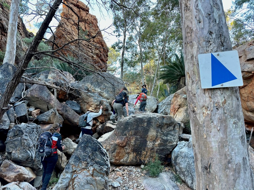
We started with a 10k out and back walk from Standley Chasm along part of Section 3, as it is not possible to get a vehicle into the Section 2/3 junction at Jay Creek. So we walked east towards Alice Springs for 5k and then turned back the same way. This sounds a little dull and easy, but due to the terrain it was far from it, so it was something of a baptism by fire!
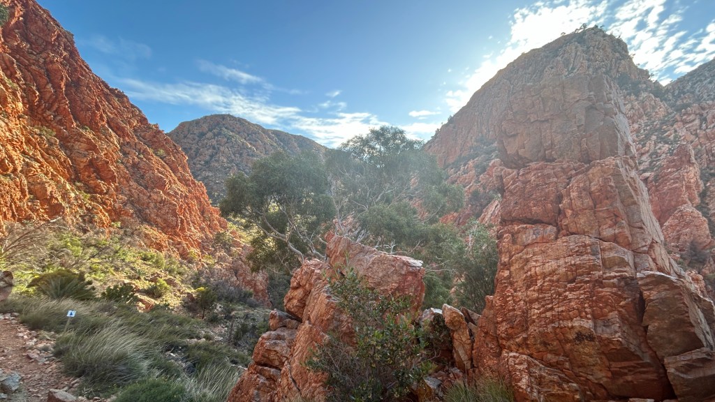
This was the section I did part of with my parents in 2018, so it was lovely to start my longer adventure with it, and my memory of it being tough going was not wrong! The very beginning was a flat, shared path with the track into the chasm (which I returned to at the end of the day), and then the climb started after an “Experienced Hikers Only” sign where we all posed for the obvious photo. After that, we headed upwards on some rather scrambly rocks, to Angkale Junction. After going up and over a ridge line (with a stop for morning tea), we ended up in a valley and a bit of respite from the scrambling. At a point called Millers Flat, we ate lunch (a delicious chickpea, feta and tomato salad pre-prepared by the guides), we turned around and headed back to Standley Chasm via the same route. All with plenty of chat, as we got to know each other, and a lot of mutual support – for example there was always someone happy to hold my poles as I scrambled up and down some of the rockier bits.
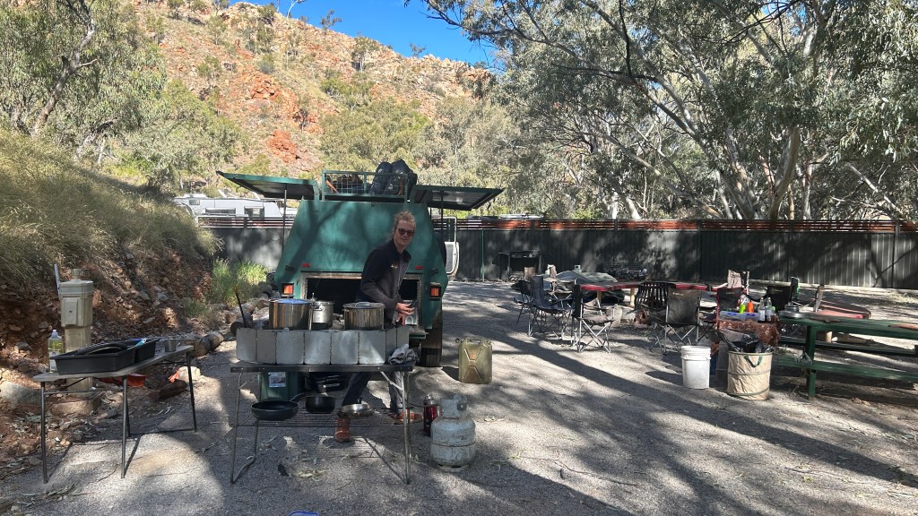
Each day, one guide walked with us while the other did all the camp prep, cooking and any driving needed (some days we moved site, other days we didn’t). Today, Sam was our hike guide and Ollie greeted us at Standley Chasm with a fire, hot water for tea and some food already being cooked on a portable gas stove which came out of the trailer. Standley was the only campsite we used with proper flush toilets, showers and a cafe, because the chasm itself is a tourist attraction – luxury we knew not to get used to. I eschewed the tea on offer in favour of a flat white from the cafe before it closed, as I knew I wouldn’t get another for a while!
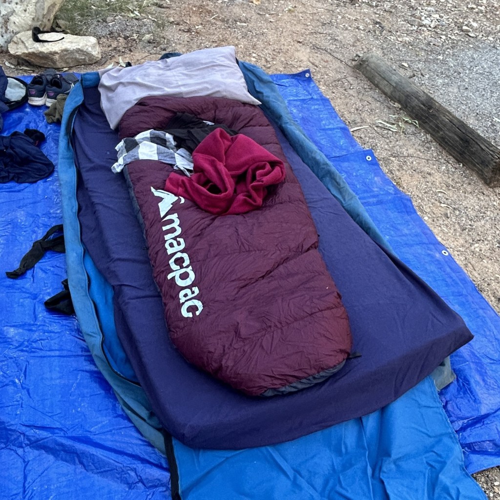
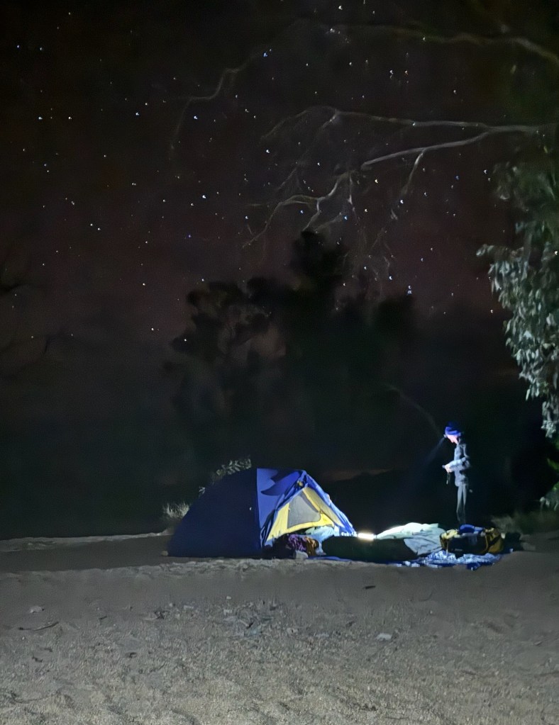
After the coffee (which wasn’t bad at all) and my last shower for four days, it was time to set up my own camping arrangement – that bit was always our own responsibility. We could choose between a tent, a swag, or both, with advice that the tent probably wasn’t necessary – more faff putting it up and (more to the point) taking it down in the morning before heading off to walk. With no rain forecast, I took the advice and rolled out a swag (basically a canvas bag with a mattress in it) and added my (borrowed – thanks, Helen!) sleeping bag, sleeping bag liner, pyjamas, thermal trousers and fleece jumper inside it.
With a BBQ also on offer here but at no other campsite, dinner was BBQed meat (sausages and kangaroo steaks) with salad and garlic bread, and as we ate we were told what to expect on Day 2. More climbing, apparently – this would become a common theme!
Dinner was early by my usual standards – 5.30pm – and everything happening early became a common theme of the trip. We were told we’d be in bed most nights by 7.30 and I didn’t really believe it, and yet….! Once then sun went down, the temperature dropped substantially from the 20 degrees or so which we’d enjoyed during the day. After dinner, we chatted around the fire for a while with hot drinks (or beer) in puffer jackets and beanies, and eventually sloped off to our swags. I hadn’t yet got my body clock fully onto Larapinta time so didn’t sleep for a while, but listened to a podcast and was probably sound asleep by 9pm. Day 1 done, onto Day 2.
Day 2 (Section 4, 19km), aka the one with the best lunch spot ever
Despite no rain on the forecast, there were a very few spots of rain in the middle of the night, leading to some scrambling amongst those of us in swags who hadn’t even zipped up our packs. Thankfully, it was over as soon as it began and I managed to hastily close the bag, so no harm done! I didn’t sleep especially well as there was more artificial light and noise from the cafe’s generator than expected, but I suspected (correctly) that none of that would be the case at the later campsites.
After a 6am alarm, 6.30 breakfast and a quick pack-up including rolling up our swags, we left camp at 7.30am to walk Section 4, which we were told was one of the most scenic but challenging sections of the trail and was ultimately one of my favourites. It was one of two days when we started our walk in one camp and finished it in the next camp with no reliance on the troopie, which I found very satisfying. We got about 100m in before one of our group panicked about where her phone was, cueing a mad run around to find it (in a “secret pocket” in the bag she had with her all along!)… so it was more like 7.50 by the time we really got underway.
The approach to walking with one guide is that one of the group leads the way with a radio, following the clear blue arrows and stopping at an agreed point for a break and for everyone to regroup, and the guide walks at the back. So everyone can go at their own pace as long as the radio person is up front – and today that was me. I swear it made me faster and more confident, and I loved just seeing the trail ahead of me. It was wonderful “me time” which I really needed after a hectic time before I left Sydney – I could almost feel my pre-trip stresses spooling out of me as I walked.
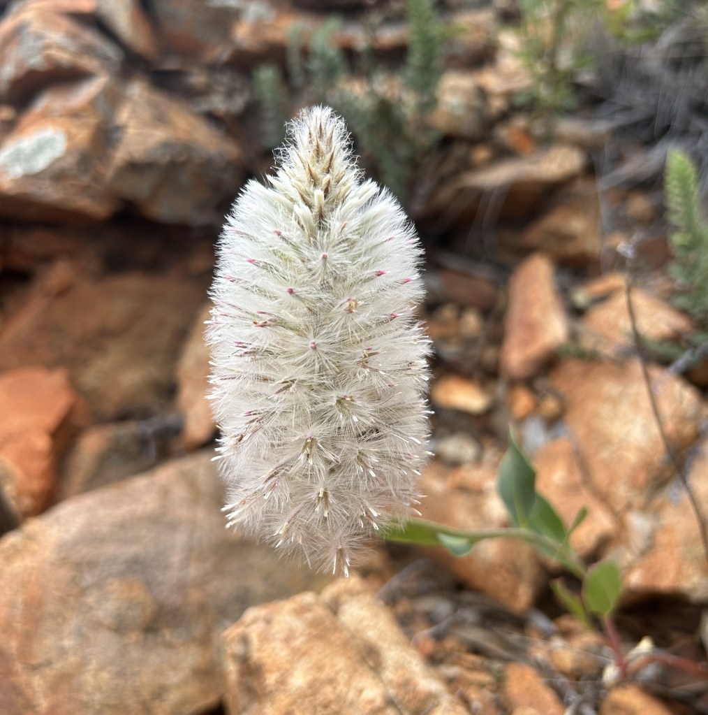
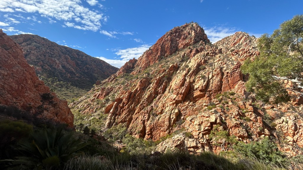
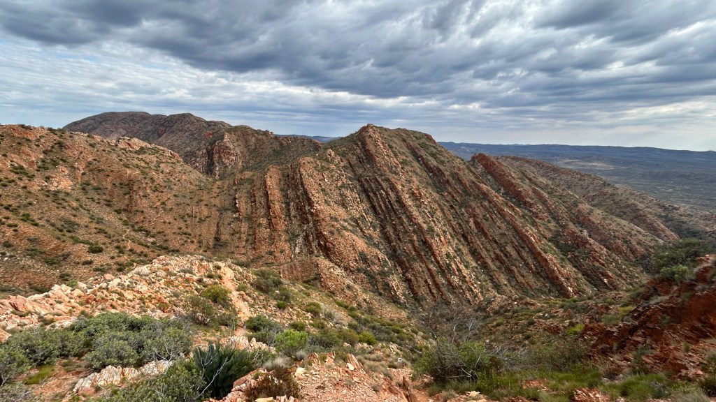
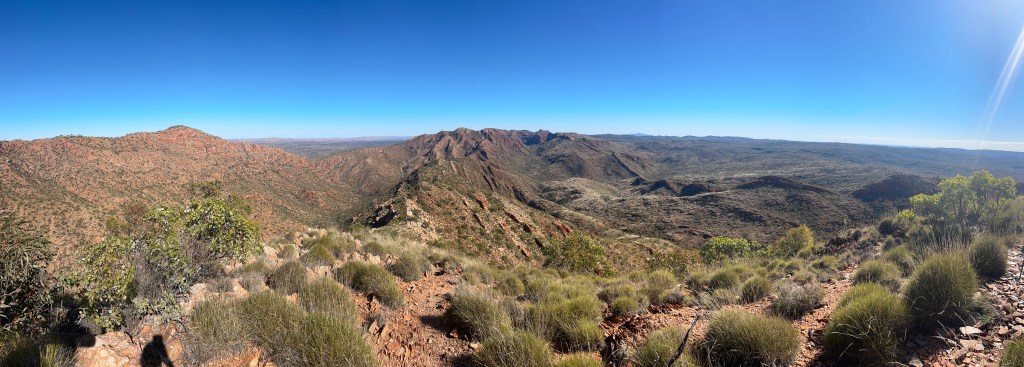
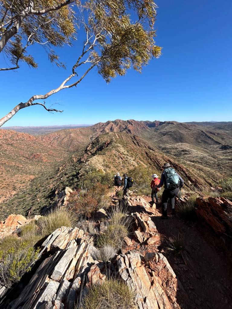
It was a gentle start with an easy first couple of kilometres along a creek bed, before we turned right and up the first of many climbs for the day. We ascended to Reveal Saddle around 5km in and then walked up the most stunning 4.5km gentle climb up along a ridge line with incredible views on both sides. Although most of what we saw was red rock, there were many different shades and types of red rock as long as a lot more green and far more wildflowers than I expected.
We reached Brinkley Bluff at 11.30 for lunch around the 10km mark. There’s a mid-section campsite up there – very exposed if it’s windy but would be a wonderful place to camp. For us, it was one of the best lunch spots ever! There was a sign proudly displaying that 3G signal was available but I was not interested – when I lost signal outside Alice, I turned on airplane mode and left it there – my normal world could wait.
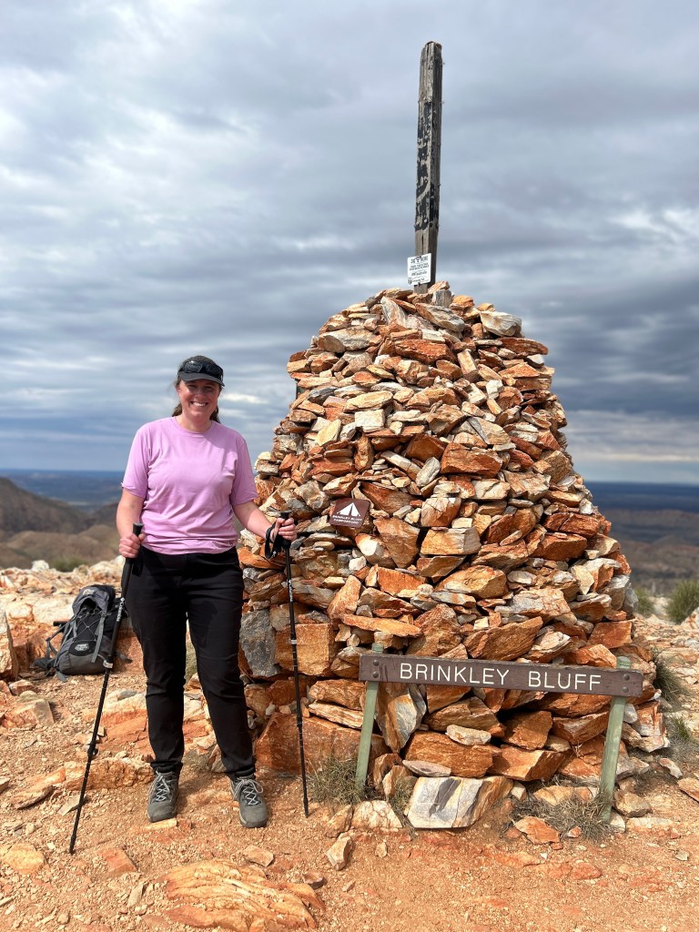
Along the way up to Brinkley Bluff, we were overtaken by a seriously rapid trail runner. At the top while we were enjoying our buckwheat tabbouleh salad, he appeared coming the other way from the steep hill we were about to go down. Half impressive, half insane! Before we departed, a few people arrived to camp, choosing a shorter day and to relax with the beautiful scenery for the afternoon
Next was a big descent, which Ollie told us is the steepest on the whole trail. It wasn’t technical and scrambly (other than in a few places) but steep, long and a had a huge number of switchbacks. I am generally more comfortable on the downhill and enjoyed leading the way. Then we headed up to one more saddle then another steep down, before hitting a creek bed. After a flat 3km we arrived at the trailhead between Sections 4 and 5, where we would return the following morning. As was often the case, we didn’t camp at the trailhead campsite but a separate, quieter spot, which added a bit of distance but was worth it. After a quick loo stop (trailhead campsite had a long drop, we had a portable toilet in a tent), we walked a very sandy kilometre to Birthday Waterhole.
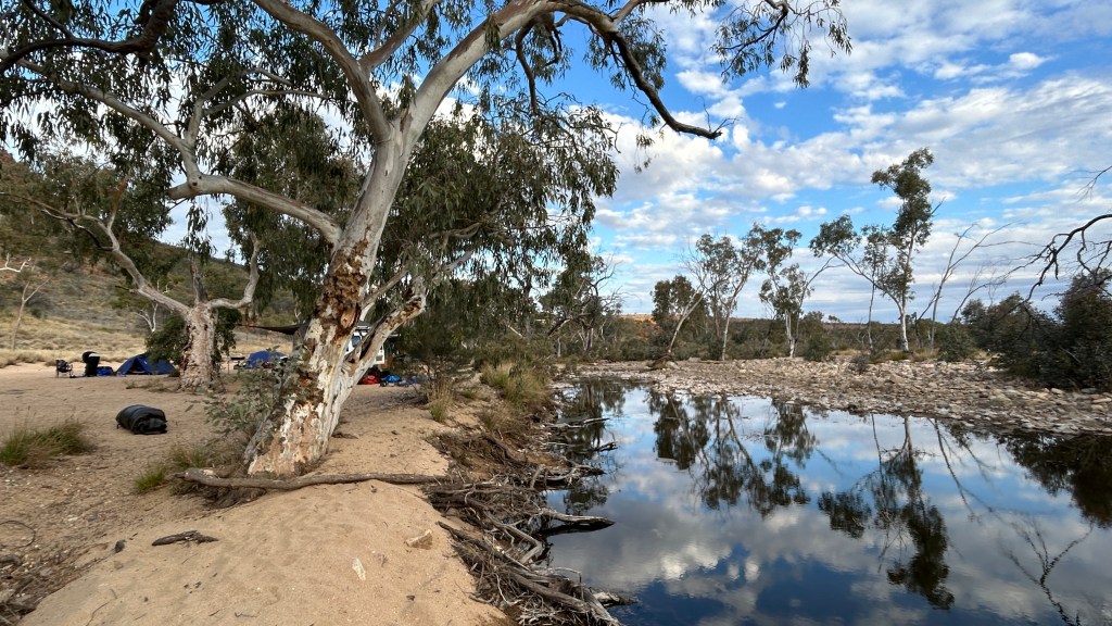
Birthday is an utterly beautiful spot (yes, common theme – I say this a lot!) and we had it to ourselves. The waterhole is there all year round, unlike most of the creeks in the area, and we had a quick dip. Unsurprisingly, in the middle of winter, it was very cold, so most of us weren’t in long, but it was refreshing and allowed at least a vague attempt at washing!
Dinner was fantastic – flathead with sweet potato, bean, feta & tomato salad, followed by a sensational chocolate and cherry cake (cooked in a camp oven using coals from the fire) with custard. Other group members kindly offered me a glass of pinot noir and, since I was finally feeling 100% after the stomach upset, I gratefully accepted. Perfect!
And tonight I did go to bed at 7.30 (in a tent,D burned by the previous night’s tiny rain sprinkle and with the forecast suggesting the possibility of a bit more tonight!), and it didn’t take me long to nod off!
Day 3 (Section 5, 18km), aka the one with the epic lasagne
I wasn’t sure yesterday could be beaten but today came pretty close – I reckon too hard to call. It was a very slightly shorter walk in terms of distance, but more technical and challenging.
It was someone else’s turn to lead with the radio today, and he set off in the wrong direction immediately after we set off from the main campsite (after the obligatory loo stop) despite two large signs, leading to chants of “We want Sarah!” and much hilarity. Once he was set straight, we headed along another dry creek bed again until we got to Spencer Gorge. Inside the gorge we headed gently uphill but the terrain was rocky with some scrambling so it wasn’t quick going.
Then we headed up Rocky Talus and Windy Saddle with amazing views both sides. But we were told the chocolate tree (the guide provided chocolate a couple of times a day, usually starting with morning tea) at was at the top of Razorback Ridge which meant more climbing before sustenance. Razorback Ridge was true to its name and absolutely stunning, and the chocolate (Whitakers coconut block) tasted all the better for being fully earned. We saw a group of Year 9 kids at the top who were doing a multi-day hike with full packs with a couple of leaders – couldn’t decide if this was total madness, amazing, or a bit of both.
After the chocolate was a big technical descent – I loved it (I really like going downwards!) but it was hard. I think I partly loved it because it was hard – I realised I could do it just fine despite this. I’d done a fair amount of training, including long day walks and twice weekly strength training, as well as getting my base fitness up through regular running, and it all felt worth it.
We stopped for lunch (a delicious potato salad) in the creek bed at the bottom. I switched to shorts and a floppy hat from trousers and cap, which was a good move – it had started to get warm (and my first pair of trousers was getting a bit filthy!). I plaited my hair as a ponytail didn’t fit under the floppy hat, and it remained in plaits for the rest of the trip – out of the way in its increasing greasy unpleasantness!
After lunch, we continued along the the creek and then up to one more saddle, aptly named Rocky Saddle (Australians like giving things straightforward names – see also Great Sandy Desert), and then down to the start of Hugh Gorge where there was a campsite, but we didn’t stop. There were just 4km to go…. but with a promise of getting wet on the way!
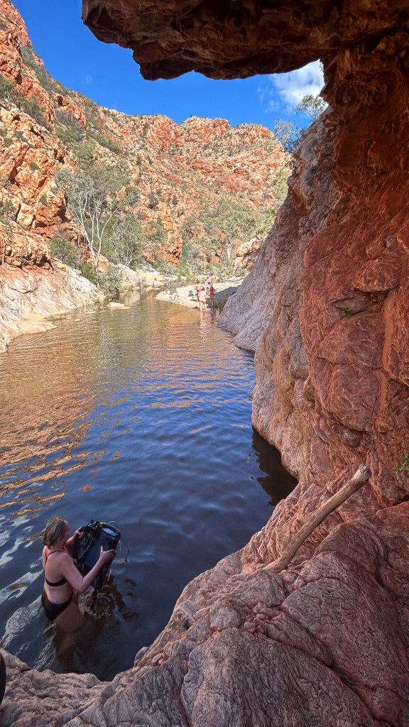
The water crossing was cold but short-lived. In turn, we each had to walk into the water, take two strokes when it got too deep to walk until it became walkable again, grab our packs from Sam, who passed them down from a rock, and walk 20m out. We were advised to do it in underwear and then change into spare underwear and get clothes back on. Despite the additional weight, I am glad I carried my Keen sandles as well.
The last 3km were mostly relatively straightforward but there was a bit of rock-hopping, with tired legs. We were very happy to see Ollie waiting for us close to the campsite, leading us in on foot.
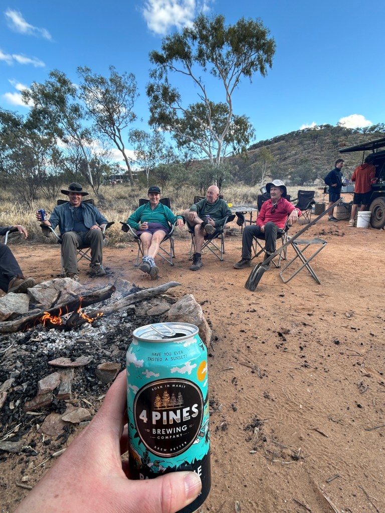
It was a clear afternoon with no need for a tent, so I rolled out my swag, got changed ready for it to get colder and sat by the fire with a beer and the (provided) chips and guacamole. Dinner was possibly the best one of the trip – the largest lasagne I have ever seen, cooked in the camp oven. We all had seconds and there was still some left for Ollie’s lunch the next day!
With the perfectly clear night, the stars were incredible and sleeping under the swag and looking at them (albeit fuzzily without my contacts in or glasses on) was a fabulous part of the experience of the trip.
Jump to: Intro |Part 2 (days 4-6) | Part 3 (days 7-9)

3 thoughts on “Hiking the Larapinta Trail – Part 1”