Hiking the Larapinta Trail – Part 3

Day 7 (Ormiston Pound Walk, 9km) – aka the one with the flat white

Today was a much, much more relaxed day, but started with a very cold night. Apparently it was -2 degrees in Alice and it would have been colder out here – my water bottle had frozen bits in it and the toilet hand wash bucket was frozen across the top when I went to use it first thing, and I needed to bash it with a hiking pole to wash my hands!

A perentie on the trail

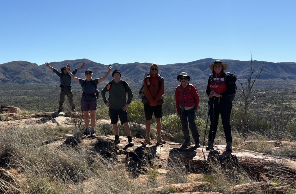
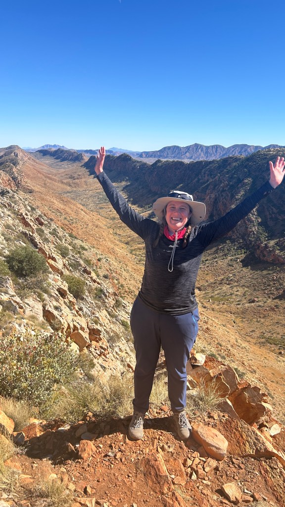
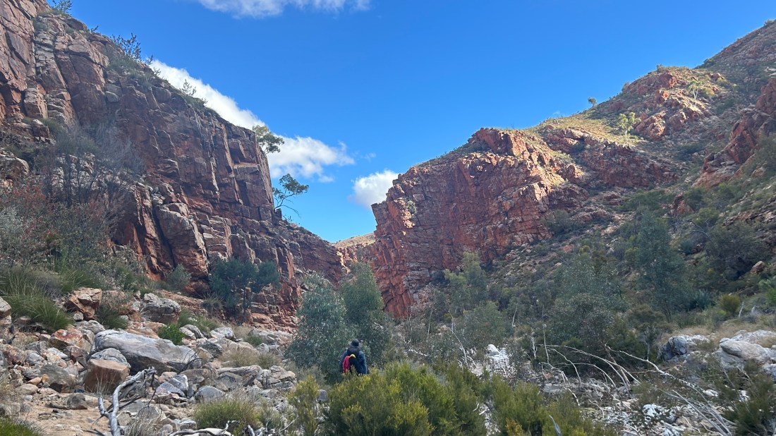
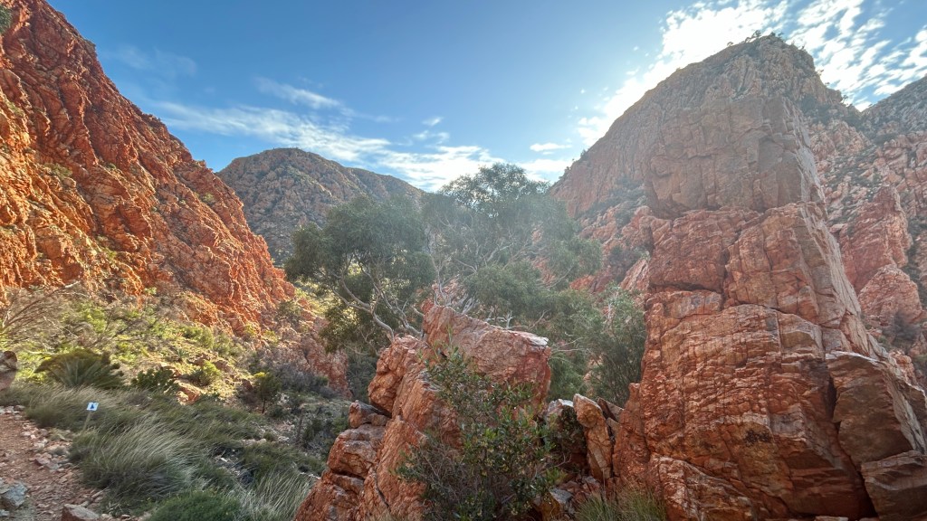
Breakfast was at 7am, a veritable lie-in, and we left camp at 8.30 as the usual night before ritual of water bottles and packing for the day’s walk was of course left to the morning, but we knew it was going to be a much shorter walk so nobody was worried. We piled into the troopie and drove back to Ormiston Gorge, where we were to do the Ormiston Pound Walk. This is known as the best side walk on the Larapinta and is a 9km circular walk – so very short compared to previous days (especially yesterday) but an absolute stunner!

Along the way, we saw a Perentie, a type of goanna which the internet tells me is Australia’s largest lizard. Sam said he’s been looking for one for the whole of the season, but he missed it as he was at the back of the group and it skulked off by the time he reached where it had been!

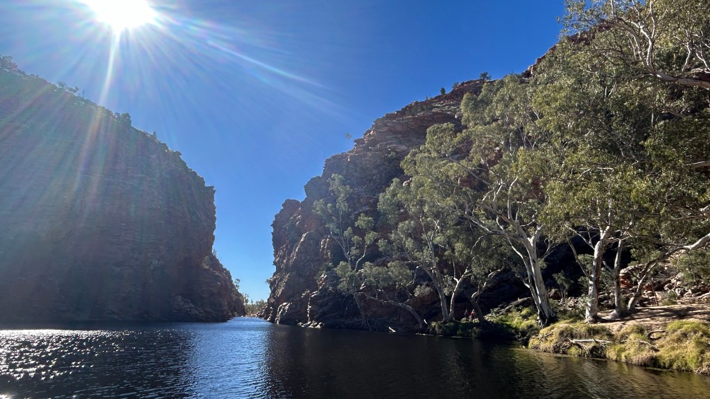
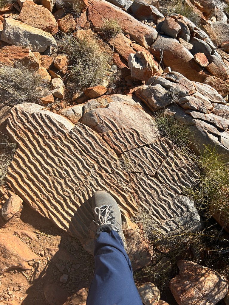
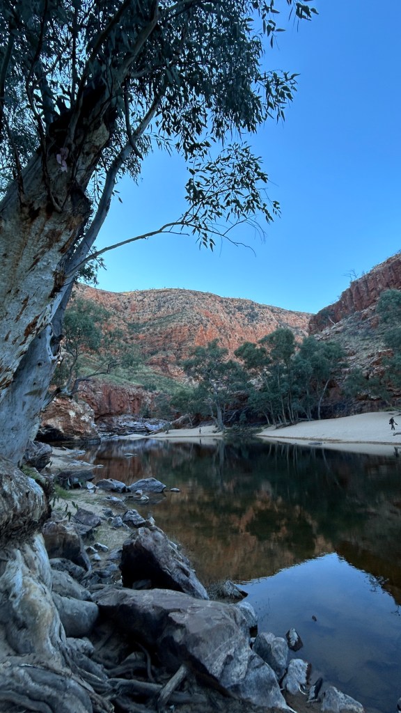
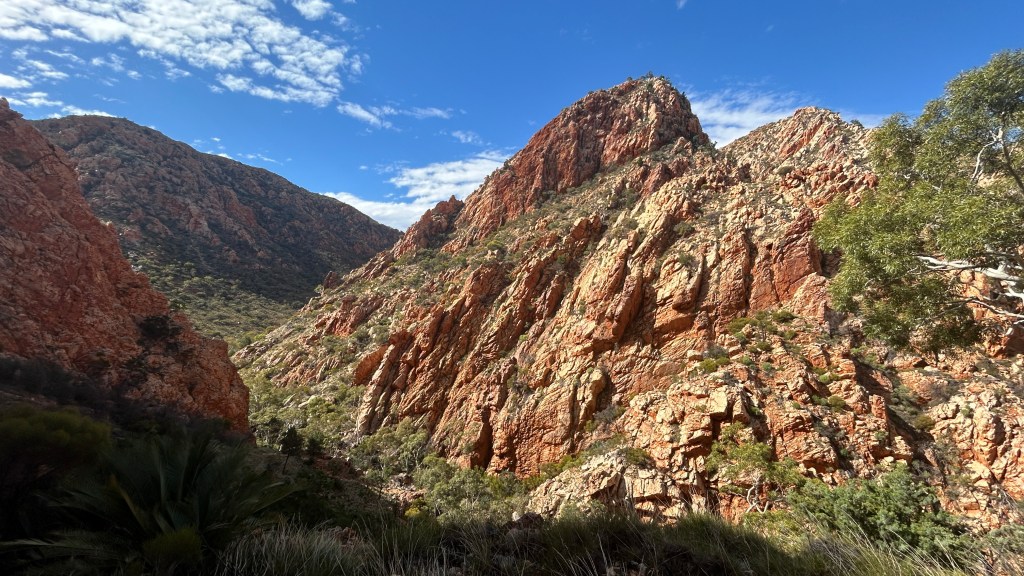
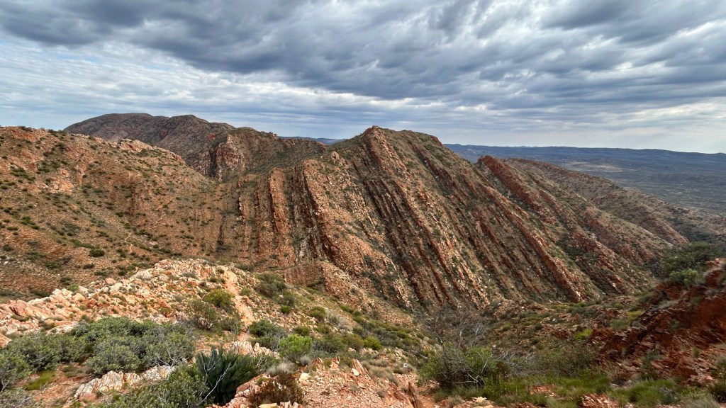
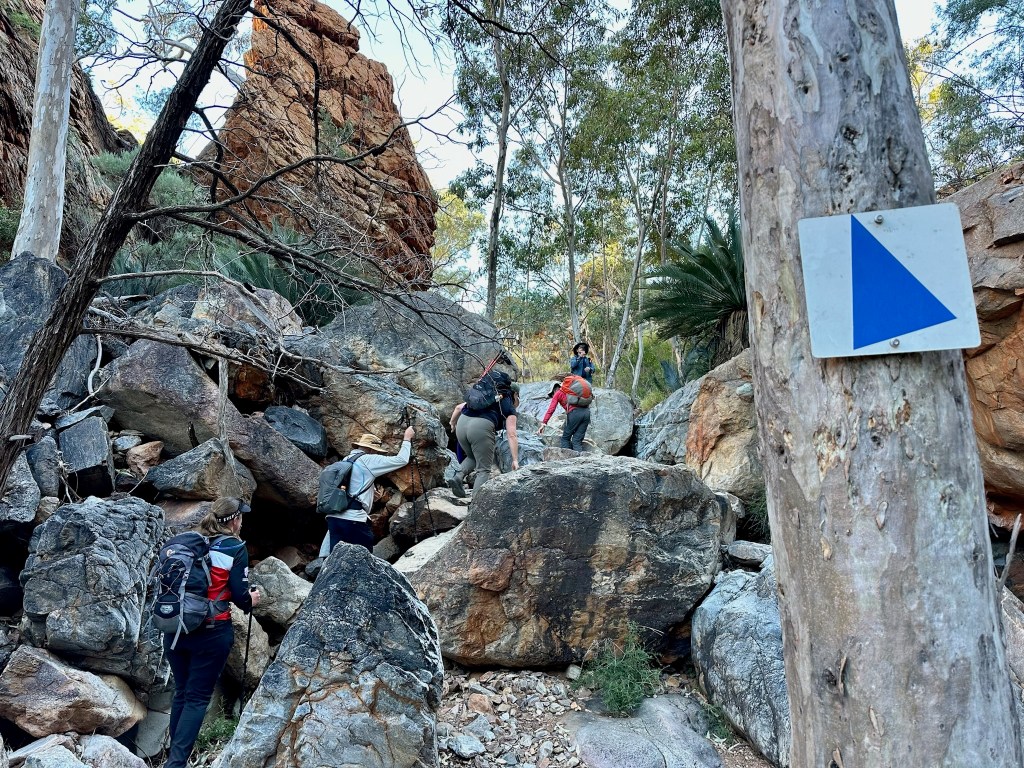
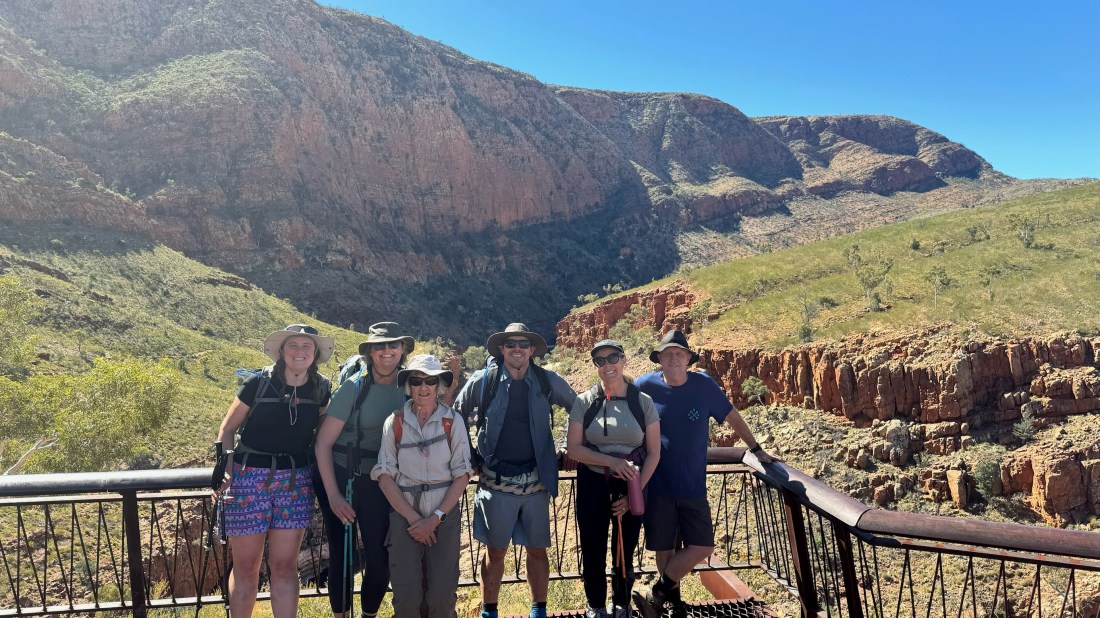
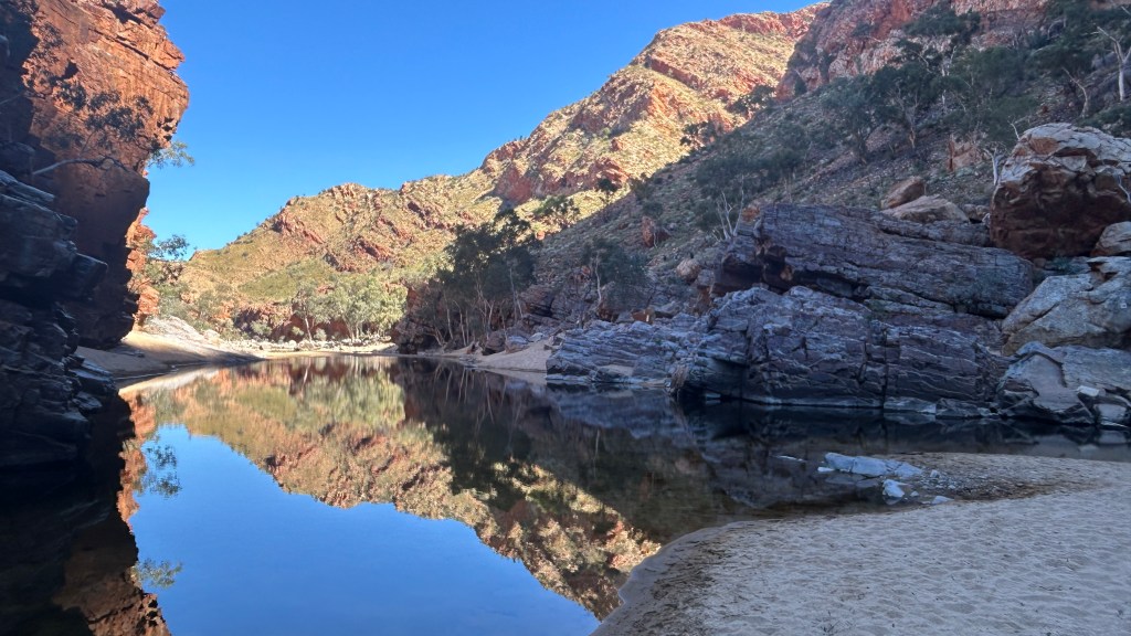
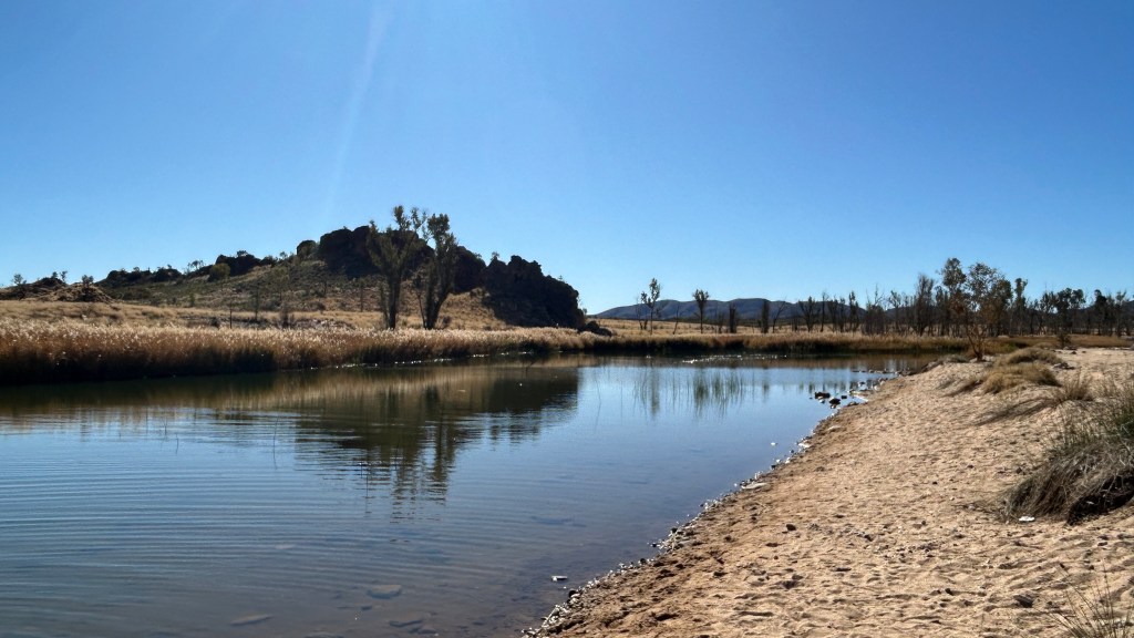
The walk circles and takes its name from a huge “pound” where cattle were once kept with natural walls on 2-3 sides. A couple of km are through the Ormiston Gorge itself, which was magical. There are so many colours in the red rock, the reflections in the water were mirror perfect, and the ghost gums clinging onto the cliffs at crazy angles were extraordinary. Out of the gorge, we headed up to the right and the Ghost Gum Lookout, which had spectacular views back to where we’d come from, then down concrete stairs (Concrete! What is that?) to the car park.

Outstanding lunch, with outstanding view!

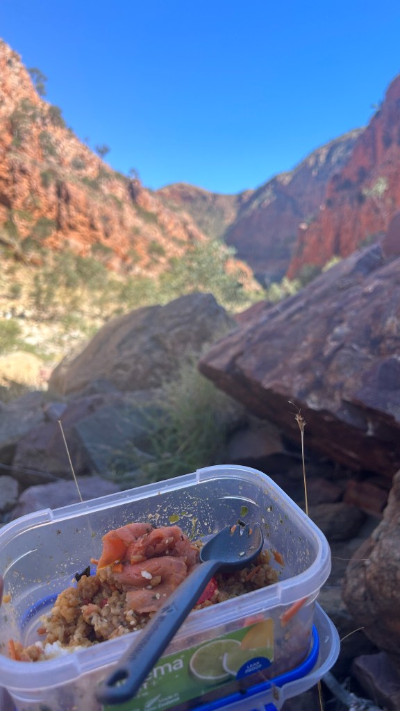
Lunch was one of the best of the trip – a deconstructed sushi bowl which we each assembled before leaving camp – not something I’d ever expect to eat on a hike!

Along the way, we saw quite a few other people and far more than any previous days – they were mostly groups (a fancy World Ex one and another company) but a few people off their own bat too. I’d certainly recommend it as a short/medium day hike if ever in the area.

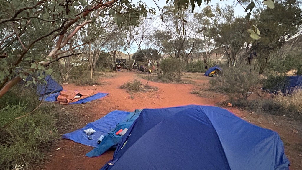
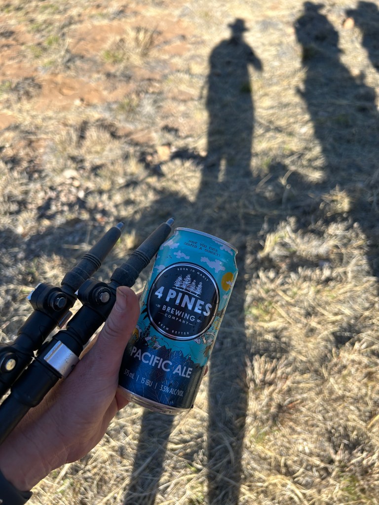
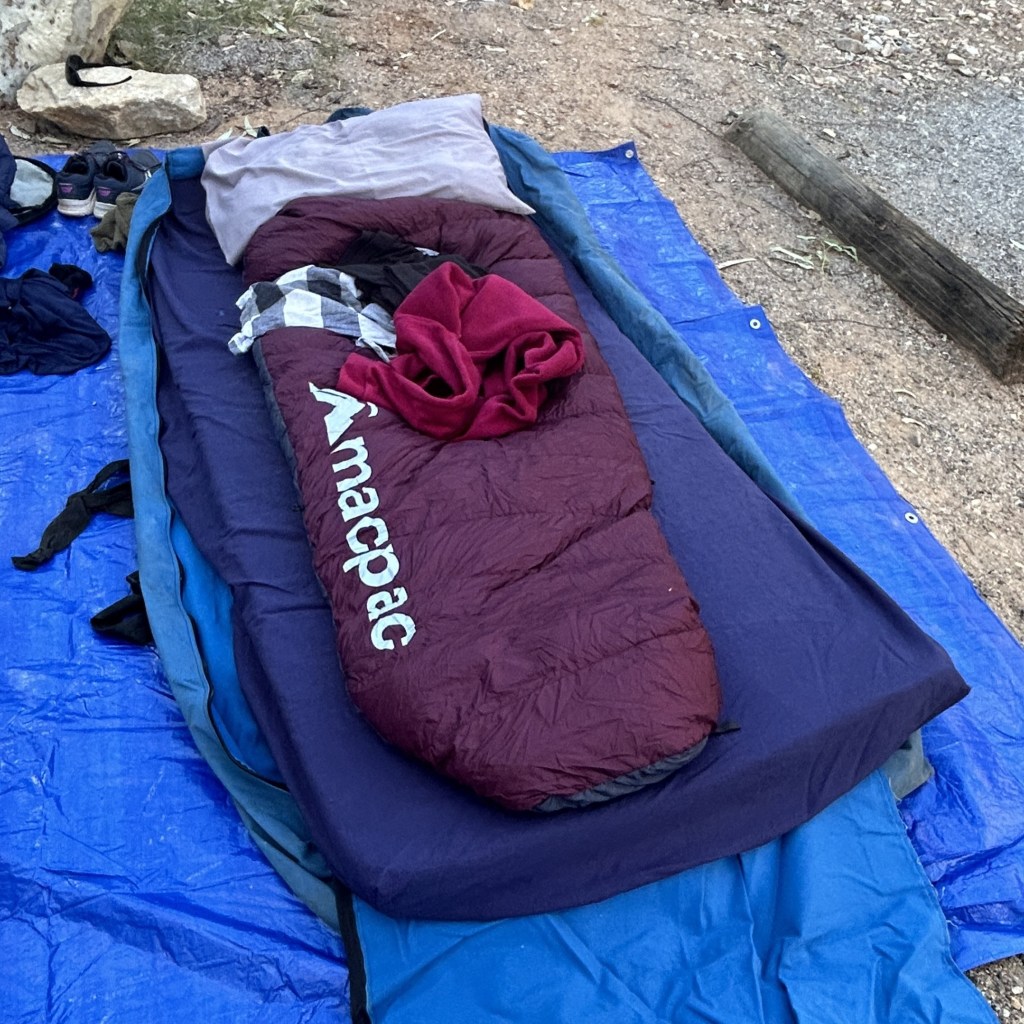
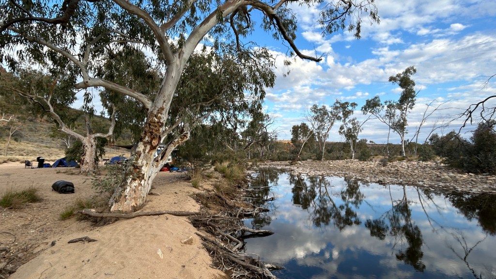
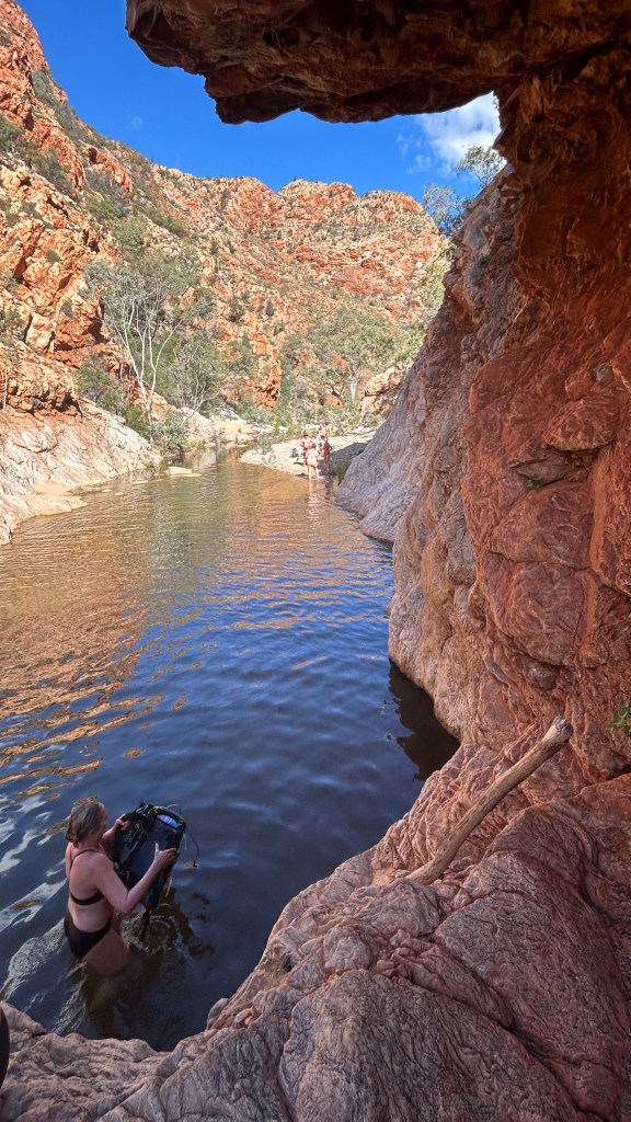
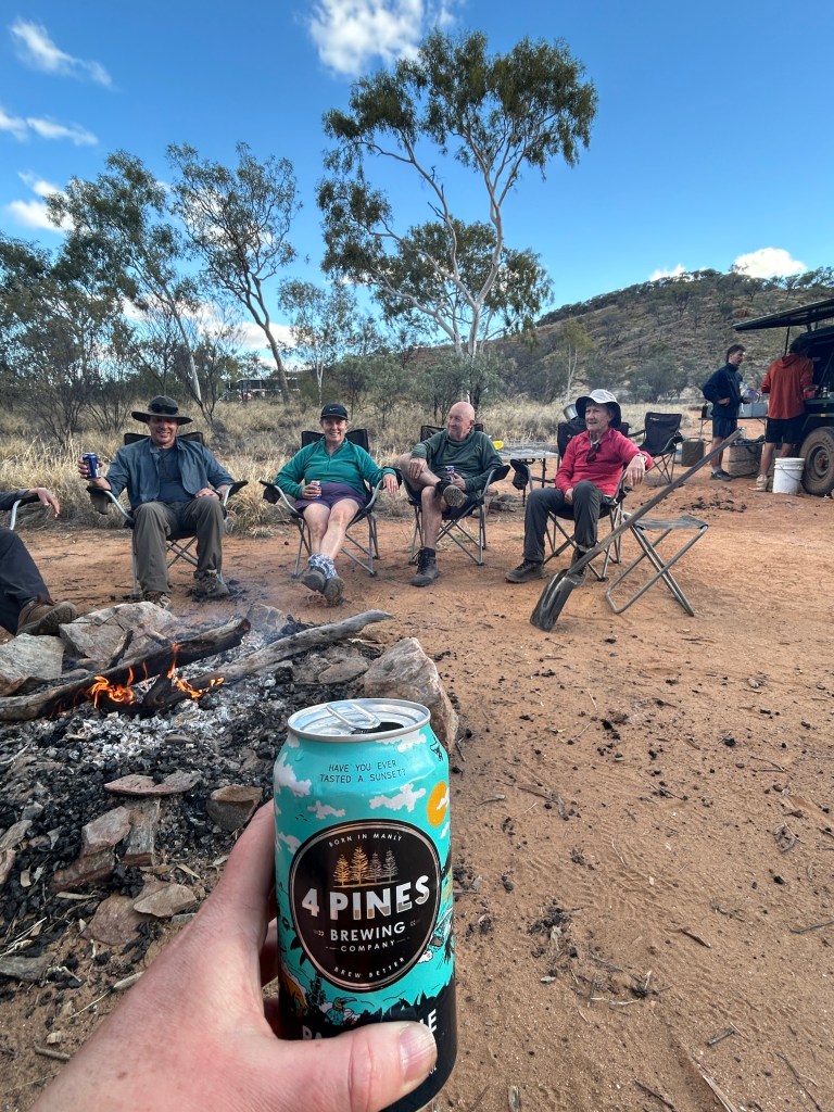
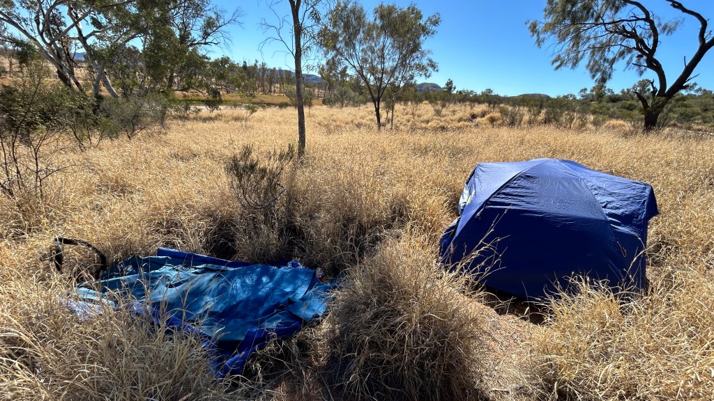
Once back in the car park, we bought coffee at the cafe (a PROPER FLAT WHITE!) and then enjoyed a wonderful swim in the gorge which was much warmer than Birthday and Ellery. Then back in the troopie and a 20 minute drive to our next and final camp at Finke River. There I found a lovely spot amongst the bufflegrass – just room for one swag and one tent, in my own little part of the site. It would do nicely as my home for the last two nights of the trip!

Day 8 (Section 11a, 17km) – aka the one where we walked into the sun

It may not have felt all that cold last night ,but it was effing freezing this morning – the condensation inside my swag had frosted as it got cooler towards dusk, along with the water left on my toothbrush! After the lie-in yesterday, we were afforded no such luxury today – we were into the troopie at 7.30 to drive to the middle of Section 11 (including some fairly serious 4WDing along the way that gave us a shake and ensured we were still awake!) and then walk the 17km back into camp.

It was the first time we’d walked west to east (other than the out and back day 1), and it was disorientating to have sun in our faces rather than at our backs in the morning but it transpired that it was the much the better way to do this section – the World Ex guys know what they are doing! Due to its length, Section 11 is one of two sections that it’s very common to do across two days, with Section 9 (which we knocked out in a day!) the other.

Mount Sonder from Hill Top Lookout

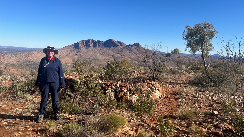
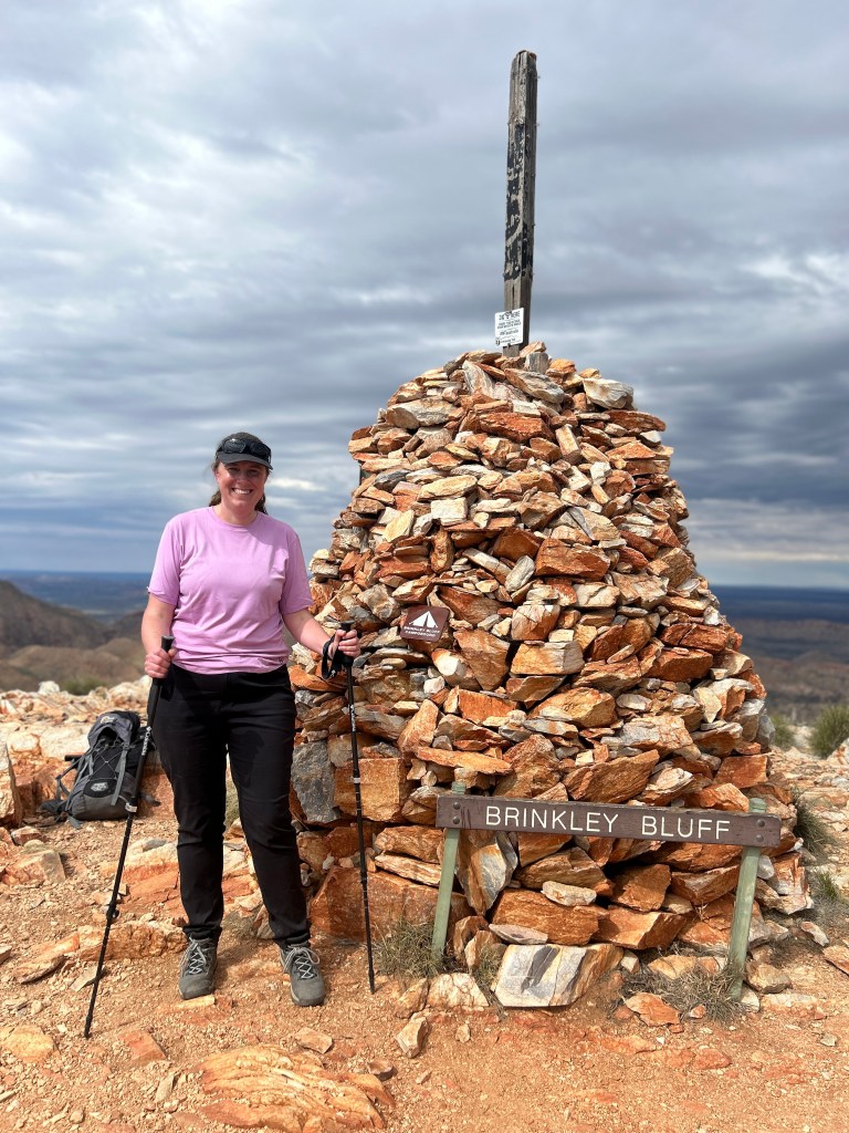
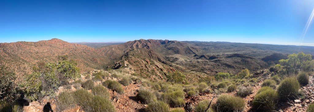
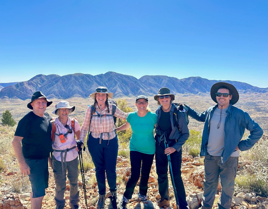
It had warmed up a fair bit by the time we started walking – I felt OK in a t-shirt and a thin long-sleeved top despite how cold it had felt a couple of hours earlier. We enjoyed 4km of “Larapinta flat” before hitting what we knew was the only climb of the day, but it was a fairly big one. It was my turn for the radio again meaning I took the lead and everyone else had to walk at my plod pace! There were amazing views of Mt Sonder throughout, especially at the top (originally named Hill Top Lookout) and we looked forward with some trepidation (keep reading to find out why the trepidation) to returning the next day. It was great to knock off the climb while it was still cool, but afterwards I switched to shorts – mostly because they were much, much cleaner than my trousers. I was very much getting to the stage of wearing what stank the least!

Finke River close to camp

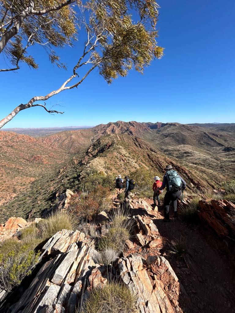
From the top, we walked along a ridge and then down a steep descent (I was very glad we were not climbing that!) with a howling gale into our faces. In the wind, we were lucky that the path was quite wide, unlike some of our other ridge walks. After the descent and about 8km into the day, we hit the flat – and this was true flat, not Larapinta flat! We had lunch around 12km in at a lovely shady spot by a river., then turned off the path at 16km to cut across to the campsite, across a wide creek. Thanks to Ollie, we managed to keep our feet dry!

Sunset at Finke River campsite

We got into camp at a very civilised 1.30pm. I enjoyed a paddle (which doubled as a bit of a wash) in the Finke River, read a book in the sun, made breakfast of nutella croissants and hard-boiled eggs, and packed for the next day’s walk up Mount Sonder. This was to be a 2.25am departure to get to the top before sunrise, and we were told to take all our warm clothes as it would be baltic at the top. Eep!

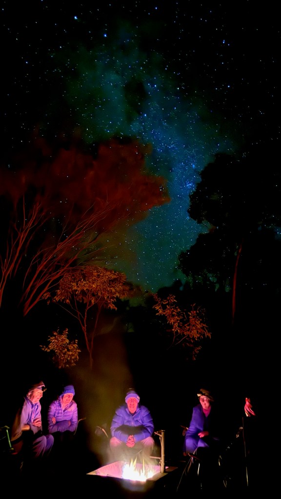
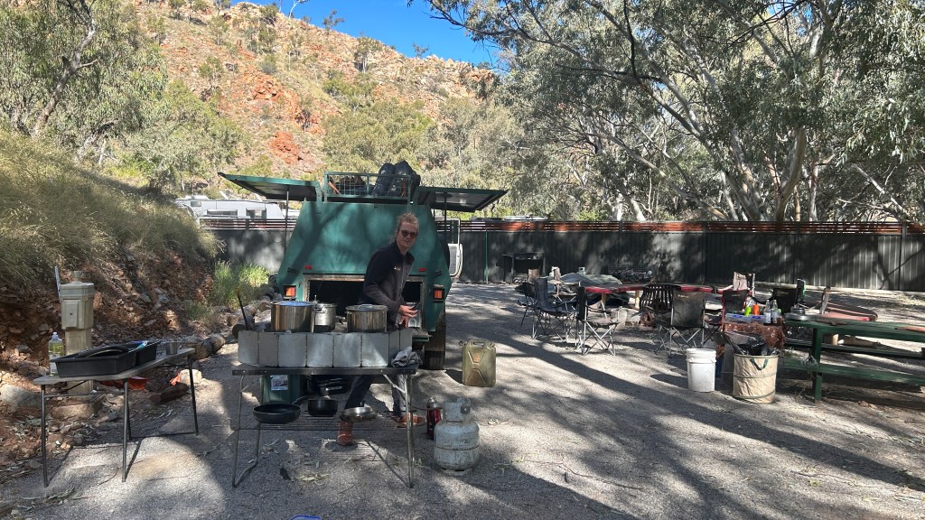
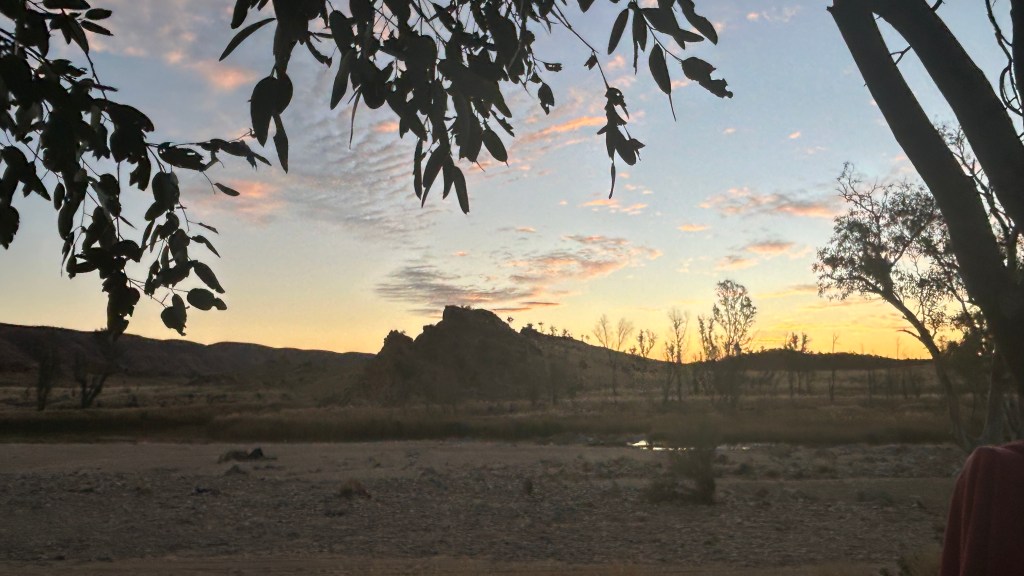
After packing, we enjoyed the entree of sun-dried tomato damper cooked in the camp oven, which was nothing short of spectacular, along with the last beer of the trip while looking at the sunset across the creek. It was weird to think I’d be in Alice Springs at the same time tomorrow, and I was sad at the idea of leaving this world behind. The main event of roast chicken and root veggies was just as good as the damper, and the addition of fruit salad made it a three course meal!

The dream team, Sam and Ollie

After dinner, I suddenly felt light-headed – I think I had seen too much sun and had an allergic reaction to something. I crashed out at a record early time of 7pm in the hope of knocking it on the head and being ready for Sonder the next morning.

Day 9 (Section 12, 16km) – aka the one with the Sonder Sunrise

Section 12 is probably the most famous one on the Larapinta, the ascent (and of course descent) of Mount Sonder, the westernmost stage of the trail. It is customary to do it mega early to be at the top for sunrise, and after doing it I can see why, because (spoiler alert!) it was spectacular!

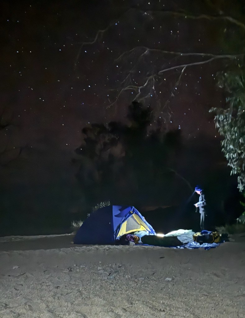
My alarm went off at 1.50am for a 2.25am departure. Thankfully, I felt a lot better than the night before and had slept pretty well. I threw on hiking clothes, put my contact lenses in at a record early time, chucked the last things in bag including several warm layers, went to the loo and got into the troopie. Thankfully, we would return to camp afterwards to pack up.

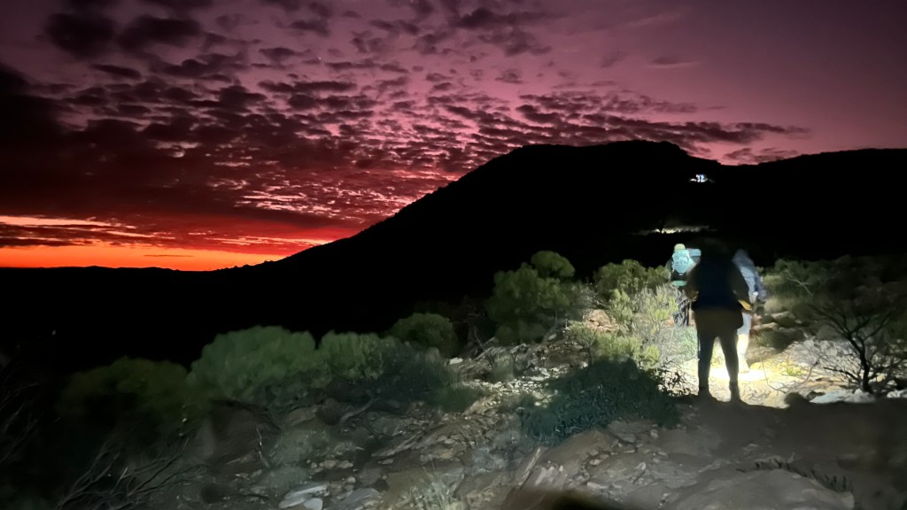
It was a half hour drive to Redbank Gorge, the base of the Sonder walk, from where we would walk up the western side. As instructed, we took layers off as we’d be going steeply uphill, and we started walking before 3.15am. All very surreal!

We’d been well briefed – it was 8km each way, with the ascent divided into three sections – 3km steep, 3km flatter, 2km steeper again to the top. We’d charged or replaced our headtorch batteries for maximum power. Sam led the way at a deliberate slow pace (a plod with minimal stopping suited me perfectly!), while the person at the rear had a red light around her neck so Sam could see we were all there.

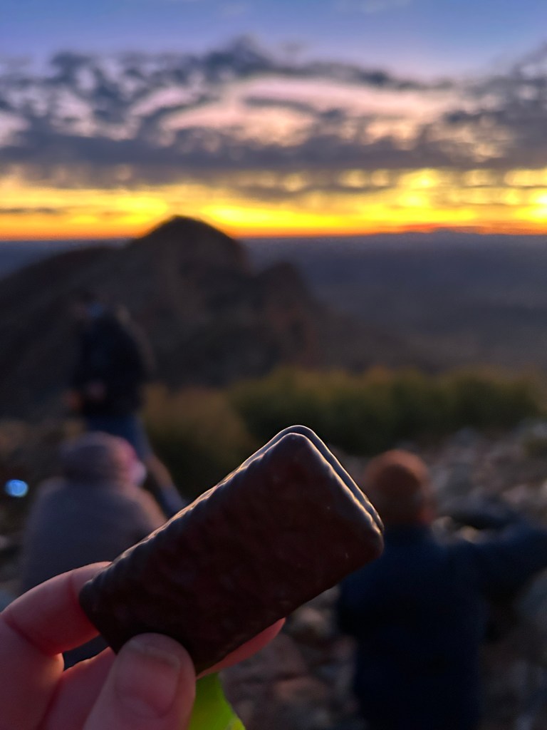
After an hour, we reached the top of the first section, and stopped for a Nutella-filled croissant and a breather (with a puffer jacket thrown on). We saw the red moon rising in the distance, which was magical. But it was a slim crescent so it was probably the darkest sky we’d had all trip. There were a couple of other groups ahead of us, so could see how steep each little part of the climb was by seeing how far up the nearest collection of headlights was!

We proceeded onwards to the second section, which took another hour or so, and then had another short break and another croissant. It was getting a bit breezy and cooler, so I put on my waterproof jacket as wind protection. I had carried it around all 140kms of the trip so far, and this was the first time I wore it!

First light from the back of the pack

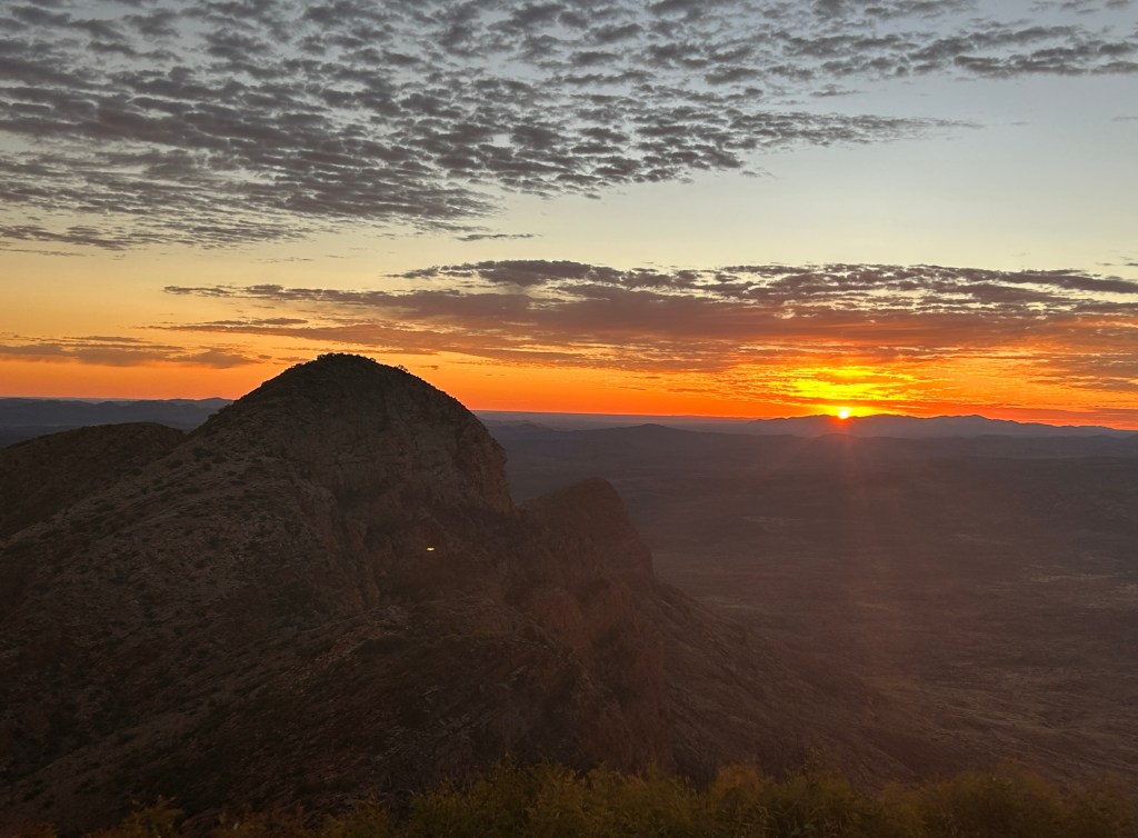
We started to see a bit of light and that there were some clouds forming overhead, and hoped (correctly, as it happened) that the clouds would enhance the sunrise. As we got fairly close to the top, the first red light peeped over the horizon, and this spread as we walked. I was close to the back and got a couple of photos of the incredible red sky with my friends walking ahead towards the bulk of the peak.

We reached the top (the “belly button” – the very top “breasts” of the pregnant lady are an indigenous sacred site) around 6.40am, 30 min before sunrise but the light was already fabulous. I put more clothes on, but it wasn’t nearly as cold as expected based on the previous couple of mornings. I enjoyed two cups of tea and a Tim tam dunked in each, while many photos were taken, and one of our group set up a time lapse on his phone which turned out brilliantly. It was fairly busy with other groups also around, but there were some fabulous views nonetheless and the other side of the mountain was lovely too.

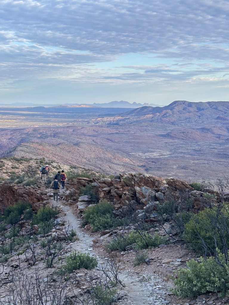
We let the other groups head down first and then started making our way down around 7.45am. We just stopped once other than to take layers off and change headgear (this was essential as the sun got to work!), and it was nice to see everything we didn’t on the way up. But in the end, it felt like a bit of a slog. Perhaps the relentless down, or perhaps it was the knowledge that this was it – the last walk of the trip. It hurt a bit now too, because it could – my body didn’t have to “get up” for it again.

Breakfast of champions!

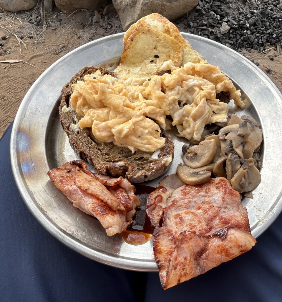
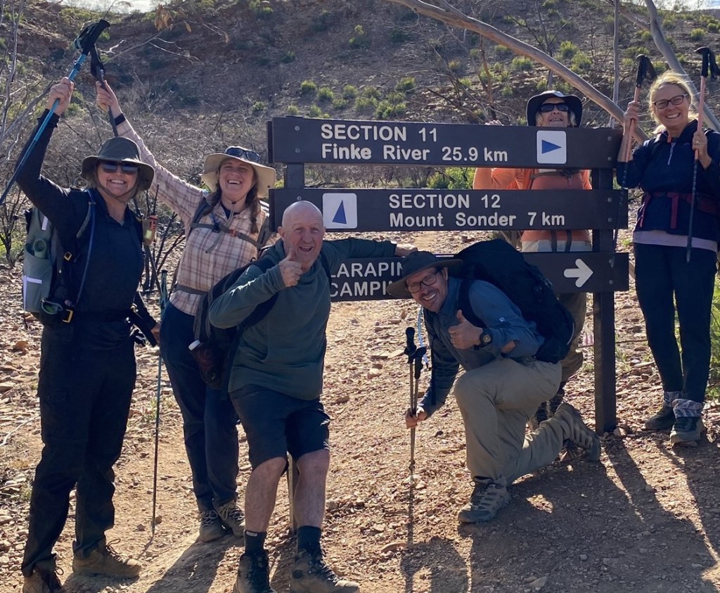
We had our final photo next to the sign at the bottom by the car park, then got into the troopie and back to camp, where Ollie was putting the finishing touches to brunch. And brunch was wonderful – scrambled egg, halloumi, mushrooms, bacon and toast. After that, packed up (oh god, everything stinks!) and got out of about 12.30.

An 80s/90s playlist accompanied the two-hour ride back to Alice, and we were demob happy but with a tinge of sadness that it was over – and a touch of the “Sonder Sillies” we’d been warned about due to the very early start. With mixed feelings, I took my phone off airplane mode and sent a few messages (mostly with Sonder sunset photos attached) to family and friends. The bubble was burst.

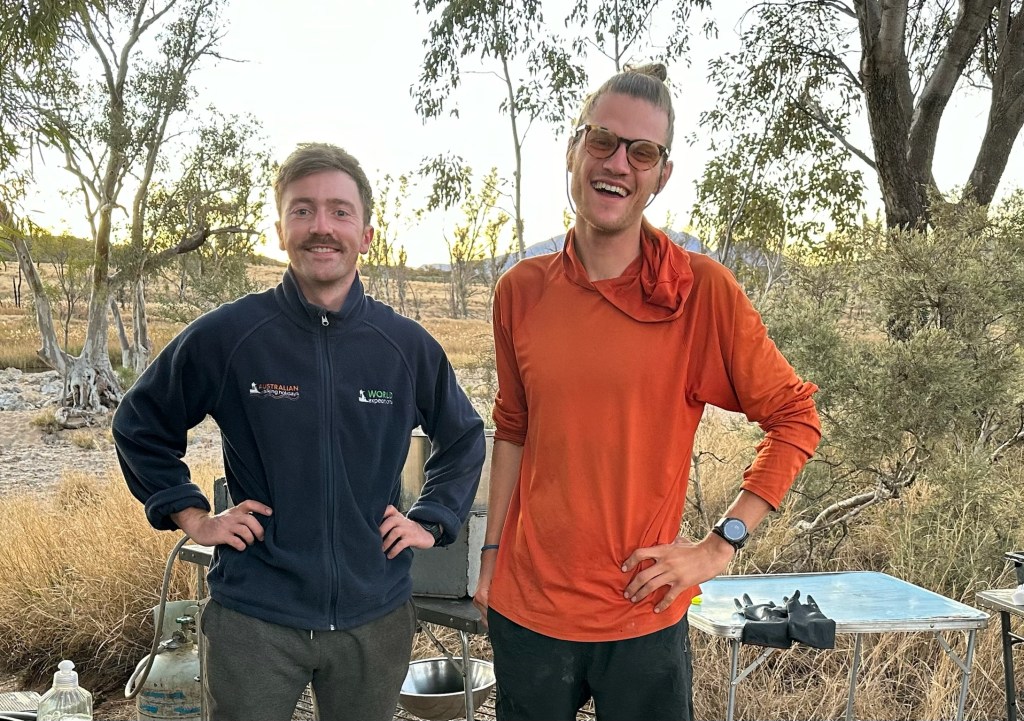
At the hotel, we said a fond farewell and profuse thanks to Sam and Ollie, who had been nothing short of wonderful – super knowledgeable, great fun, generous with their time, patient, and exceptional exponents of the camp oven!

The best thing about the return to civilisation was a hot shower, where I remained for a long, long time. I then met the rest of the group in the bar for a few beers and we headed for our farewell dinner at Indian restaurant, Hanuman. Even though there was no camp oven in sight, it was still delicious, and lovely to spend one final evening with my new friends. But boy was I ready for bed once we’d finished eating.

My 9 days on the Larapinta Trail genuinely constitute one of the best things I have ever done. I am putting the finishing touches to this blog nearly 5 months later and it’s been wonderful to look through the photos again and reminisce – I hope to be back one day, and perhaps I’ll even tackle it end to end!

Jump to: Intro | Part 1 (days 1-3) | Part 2 (days 4-6)

Hiking the Larapinta Trail – Part 2

Day 4 (half of Section 6, 15 km), aka the one with the big hole

Today started with a lie-in (7am for a 7.30am breakfast serious luxury!) and we headed out of camp at 8.30am to walk the first half of Section 6. After two incredible but challenging days, we were told today’s walking would be easier, and this was certainly true (and welcome!). Section 6 is one of the longest sections of the trail, at 29km, but we cut it short at Rocky Gully where there is vehicle access.

We achieved 11km before lunch and completed the 15km walk in the early afternoon. There were undulations for sure, but nothing on the scale of Sections 4 and 5. The troopie met us and, for the first time in over three days, we got into a vehicle and moved under something other than our own steam.

Ellery Creek Big Hole

To get out of Rocky Gully took 25 minutes on a very wobbly road, but we then hit the relative highway to Ellery Creek Big Hole (where Section 6 ends). Here was a beautiful waterhole, although there were quite a few people so I was glad we were not camping there. I was told there was Optus signal , but once again I was not interested! The waterhole was huge (30m deep!) and we had a swim and a quick wash, but it was short-lived since the water was utterly freezing – the guides reckoned about 10 degrees!

Serpentine Chalet campsite

We then piled back into the troopie and half an hour later arrived at the Serpentine Chalet campsite at the junction of Section 7 (which we skipped) and Section 8 (tomorrow’s walk). Serpentine Chalet was to be our home for three nights. THREE NIGHTS! So no need to pack anything up tomorrow morning! I pitched a tent for my gear and wet weather backup (which I did not need!), rolled out the swag, had a cup of tea and read my book for a while before dinner.

Speaking of dinner, yes it was once again amazing – veggie satay and wraps, followed by a sensational apple crumble cooked in the camp oven. And having not got up quite so early, we stayed up “late” (8.30!) around the fire, telling stories and playing around with the iPhone’s impressive night-time photo settings.

Day 5 (Section 8, 14km), aka the one with the hot shower

Four nights in, I finally slept really, really well… but dear god it was cold when I needed to get up in the night for the toilet, and when the alarm went off at 6am, evidenced by the amount of condensation inside my swag. I was a bit all over the place getting ready and we left a little late, but at 7.40 we piled into the troopie for the drive to the start of Section 8.

There was a big early climb to get the heart going, and then a lovely long ridge-line climb, to Counts Point – so named because you can count the highest peaks in the NT. These include including Mt Zeil (the highest in the Territory) and, in the distance, Mt Sonder, which we are climbing on Friday morning (it looks a little like a pregnant lady, we will climb the tummy!). On a trip full of sensational views, this was probably the best so far and I was just as happy as the photo suggests.

At the top, we came across two groups from Trek Larapinta, a competitor to World Expeditions, and with whom I seriously considered travelling. My choice was based on the stages included in the 9-day trip, where I took advice from a friend, but chats with the Trek Larapinta group endorsed my decision heartily. They had a larger group which seemed to have a greater range of speed (though this is due to luck as well as group size, I appreciate!) and they made more use of base camps with less movement between campsites, whereas I enjoyed walking in and out of camp where we could.

Waves on the rock thought to be the result of an ancient weather event

After morning tea and many, many photos at Counts Point, we returned to the junction (detour of 700m each way to the top was totally worth it!) and then descended before we stopped for lunch (with another view), 10km in. Lunch was a Vietnamese chicken noodle salad and was probably the best yet. Today was already a very good day, and it got better…

Fancy camp bathroom!

After another couple of km, we took a left off the trail on a private path to a “fancy camp” owned by World Ex, which they use for their 6-day “in comfort” trips. There were safari tents with wooden floors, a seating area under a canopy and…. HOT SHOWERS!! The showers were the reason for our visit, carefully planned to be early enough in the afternoon that we could get out before the fancy group arrived. The showers operate using a very simple but clever system – a bucket with a tap and shower head, which you fill with hot water, on a pulley to allow it to be raised and lowered. I went first so had plenty of time for a cup of tea on the comfy seats as well, and to charge my phone for a bit (and then write most of this!).

While we had been walking and then luxuriating, Ollie had taken the troopie and trailer to Alice Springs for the mid-trip restock, so we could enjoy fresh food, restocked ice in the esky, and… errm… an emptied camp toilet. When back at camp, it was all about getting prepared for tomorrow which was to be the longest walk of the trip at 31km.

We did everything we could to be ready – filling up water bottles, making breakfast (to eat on the trail after the first hour’s walk in the dark), making lunch, grabbing snacks, preparing a pile of clothes to walk in, and packing the bag to go again. Then we enjoyed entree (cheese and crackers, freshly purchased in town), dinner (Japanese curry, up to standard again!) and a cold beer as it would be rude not to take advantage of the fresh ice. And bedtime was around 7pm ahead of the 4.50 alarm tomorrow!

Day 6 (Section 9, 30km, aka the long one with the best beer of all time)

The ubiquitous blue arrow signposts… but this one with an intimidating number!

This was the day in the itinerary which had been spooking me since I booked the trip in January. I’d previously only once walked 30km in a day and it pretty much broke me, so I approached Section 9 with more than a little trepidation!

We walked out of camp at 5.30am by the light of our headtorches, with breakfast in our packs ready to eat at our first stop (but a cereal bar and banana munched before and as we set off, to keep the wolf from the door). We passed the public hikers’ campsite where there was lots of activity, and after 4km entered Inarlanga Gorge and stopped for breakfast. As we ate, Ollie explained that this is the boundary between the lands of two indigenous tribes and therefore was historically a big trading area. By the end of breakfast, it was pretty much light, so we continued without headlamps.

There was a fair bit of what we had come to call “Larapinta flat” (i.e. undulating, but as flat as it gets in these parts), but then up a big climb to Mt Giles Lookout – as long and steep as any climb we’d done in the previous five days. I was at the back of the groupbut my “plod pace” worked just fine to get me there. We enjoyed lunch at the top with spectacular views of Mt Sonder, and 16km already down. Sam later told us that the time we left Mt Giles was as early as any group he’s walked with all season so we were quite proud of that! I felt good at this point, but knew that may not last!

Next was a big ridge line walk and then a left turn to go down a spur, which took us into the Alice Valley. By this point, with 8km to go, we were starting to hurt. What was left to walk was not hard (you could almost call it flat, not just Larapinta flat!) but it was getting warm, and there was no shade and no wind. The new hiking shirt I’d bought on a whim was worth every cent of the $80 I paid for it. After feeling so good at lunchtime, I was now barely clinging on.

Best beer EVER!

We stopped in a rare patch of shade to change our socks (a recommendation from Sam and Ollie to feel a bit fresher for the final stretch), have some sugar, and put on sunscreen. The remaining 5km was almost interminable but we got there! We cut off the trail when it hit the road (with 1km to go before the end of the stage at Ormiston Gorge), and the troopie came around the corner with a beep to save us! Sam emerged with an esky, proclaiming: “Save water, drink beer!”. What a hero! We all agreed this was on the podium for the best beer we had ever had.

Ormiston Gorge

After necking the beers which barely touched the sides, we piled into the troopie and headed to Ormiston Gorge to use the toilets and paddle in the gorge. We were to go back tomorrow for a loop walk and a longer swim opportunity so didn’t linger too long, but it was lovely to get the boots off and the feet in the cold water.

Despite all the activity at the campsite before 6am, we saw very few other hikers today – most independent walkers do it in two halves given the length, and it is too remote for most tour groups. So we felt quite the sense of achievement as we sat, exhausted, around the fire enjoying our (once again delicious) pumpkin and chorizo gnocchi followed by chocolate mousse!

Jump to: Intro | Part 1 (days 1-3) | Part 3 (days 7-9)

Hiking the Larapinta Trail – Part 1

Last week I wrote the pre-amble to my 9-day hike in the Red Centre, now we get into the actual trip!

Day 1 (Section 3 return walk, 10km), aka the one that was surprisingly hard

After a 7am collection from the hotel, our bags in/on top of the trailer and hikers in the troopie, we headed 40-50km west out of Alice to Standley Chasm. The Larapinta Trail starts at the Telegraph Station just outside Alice, but we were skipping the first two sections and part of the third and starting at the junction of Sections 3 and 4.

The Trail is divided into 12 sections of between 9 and 31km, with campsites at each junction but also in the middle of many sections, and 4WD access to most of the junctions and a few other points. This makes it feasible to do many of the sections as day walks, and for end-to-end hikers to do it as quickly or slowly as they like (aided by food drops). World Expeditions’ end-to-end trip does it in 14 days, splitting Sections 6 and 11 each into two. Over nine days, we did all of Sections 4, 5, 8, 9 and 12, part of each of 3, 6 and 11, and a side walk, the Ormiston Pound Walk.

We started with a 10k out and back walk from Standley Chasm along part of Section 3, as it is not possible to get a vehicle into the Section 2/3 junction at Jay Creek. So we walked east towards Alice Springs for 5k and then turned back the same way. This sounds a little dull and easy, but due to the terrain it was far from it, so it was something of a baptism by fire!

This was the section I did part of with my parents in 2018, so it was lovely to start my longer adventure with it, and my memory of it being tough going was not wrong! The very beginning was a flat, shared path with the track into the chasm (which I returned to at the end of the day), and then the climb started after an “Experienced Hikers Only” sign where we all posed for the obvious photo. After that, we headed upwards on some rather scrambly rocks, to Angkale Junction. After going up and over a ridge line (with a stop for morning tea), we ended up in a valley and a bit of respite from the scrambling. At a point called Millers Flat, we ate lunch (a delicious chickpea, feta and tomato salad pre-prepared by the guides), we turned around and headed back to Standley Chasm via the same route. All with plenty of chat, as we got to know each other, and a lot of mutual support – for example there was always someone happy to hold my poles as I scrambled up and down some of the rockier bits.

Each day, one guide walked with us while the other did all the camp prep, cooking and any driving needed (some days we moved site, other days we didn’t). Today, Sam was our hike guide and Ollie greeted us at Standley Chasm with a fire, hot water for tea and some food already being cooked on a portable gas stove which came out of the trailer. Standley was the only campsite we used with proper flush toilets, showers and a cafe, because the chasm itself is a tourist attraction – luxury we knew not to get used to. I eschewed the tea on offer in favour of a flat white from the cafe before it closed, as I knew I wouldn’t get another for a while!

After the coffee (which wasn’t bad at all) and my last shower for four days, it was time to set up my own camping arrangement – that bit was always our own responsibility. We could choose between a tent, a swag, or both, with advice that the tent probably wasn’t necessary – more faff putting it up and (more to the point) taking it down in the morning before heading off to walk. With no rain forecast, I took the advice and rolled out a swag (basically a canvas bag with a mattress in it) and added my (borrowed – thanks, Helen!) sleeping bag, sleeping bag liner, pyjamas, thermal trousers and fleece jumper inside it.

My swag setup (before I zipped it up!)

With a BBQ also on offer here but at no other campsite, dinner was BBQed meat (sausages and kangaroo steaks) with salad and garlic bread, and as we ate we were told what to expect on Day 2. More climbing, apparently – this would become a common theme!

Ollie and the camp kitchen

Dinner was early by my usual standards – 5.30pm – and everything happening early became a common theme of the trip. We were told we’d be in bed most nights by 7.30 and I didn’t really believe it, and yet….! Once then sun went down, the temperature dropped substantially from the 20 degrees or so which we’d enjoyed during the day. After dinner, we chatted around the fire for a while with hot drinks (or beer) in puffer jackets and beanies, and eventually sloped off to our swags. I hadn’t yet got my body clock fully onto Larapinta time so didn’t sleep for a while, but listened to a podcast and was probably sound asleep by 9pm. Day 1 done, onto Day 2.

Day 2 (Section 4, 19km), aka the one with the best lunch spot ever

Despite no rain on the forecast, there were a very few spots of rain in the middle of the night, leading to some scrambling amongst those of us in swags who hadn’t even zipped up our packs. Thankfully, it was over as soon as it began and I managed to hastily close the bag, so no harm done! I didn’t sleep especially well as there was more artificial light and noise from the cafe’s generator than expected, but I suspected (correctly) that none of that would be the case at the later campsites.

After a 6am alarm, 6.30 breakfast and a quick pack-up including rolling up our swags, we left camp at 7.30am to walk Section 4, which we were told was one of the most scenic but challenging sections of the trail and was ultimately one of my favourites. It was one of two days when we started our walk in one camp and finished it in the next camp with no reliance on the troopie, which I found very satisfying. We got about 100m in before one of our group panicked about where her phone was, cueing a mad run around to find it (in a “secret pocket” in the bag she had with her all along!)… so it was more like 7.50 by the time we really got underway.

The approach to walking with one guide is that one of the group leads the way with a radio, following the clear blue arrows and stopping at an agreed point for a break and for everyone to regroup, and the guide walks at the back. So everyone can go at their own pace as long as the radio person is up front – and today that was me. I swear it made me faster and more confident, and I loved just seeing the trail ahead of me. It was wonderful “me time” which I really needed after a hectic time before I left Sydney – I could almost feel my pre-trip stresses spooling out of me as I walked.

It was a gentle start with an easy first couple of kilometres along a creek bed, before we turned right and up the first of many climbs for the day. We ascended to Reveal Saddle around 5km in and then walked up the most stunning 4.5km gentle climb up along a ridge line with incredible views on both sides. Although most of what we saw was red rock, there were many different shades and types of red rock as long as a lot more green and far more wildflowers than I expected.

View from Reveal Saddle

We reached Brinkley Bluff at 11.30 for lunch around the 10km mark. There’s a mid-section campsite up there – very exposed if it’s windy but would be a wonderful place to camp. For us, it was one of the best lunch spots ever! There was a sign proudly displaying that 3G signal was available but I was not interested – when I lost signal outside Alice, I turned on airplane mode and left it there – my normal world could wait.

Made it to the top!

Along the way up to Brinkley Bluff, we were overtaken by a seriously rapid trail runner. At the top while we were enjoying our buckwheat tabbouleh salad, he appeared coming the other way from the steep hill we were about to go down. Half impressive, half insane! Before we departed, a few people arrived to camp, choosing a shorter day and to relax with the beautiful scenery for the afternoon

Next was a big descent, which Ollie told us is the steepest on the whole trail. It wasn’t technical and scrambly (other than in a few places) but steep, long and a had a huge number of switchbacks. I am generally more comfortable on the downhill and enjoyed leading the way. Then we headed up to one more saddle then another steep down, before hitting a creek bed. After a flat 3km we arrived at the trailhead between Sections 4 and 5, where we would return the following morning. As was often the case, we didn’t camp at the trailhead campsite but a separate, quieter spot, which added a bit of distance but was worth it. After a quick loo stop (trailhead campsite had a long drop, we had a portable toilet in a tent), we walked a very sandy kilometre to Birthday Waterhole.

Birthday is an utterly beautiful spot (yes, common theme – I say this a lot!) and we had it to ourselves. The waterhole is there all year round, unlike most of the creeks in the area, and we had a quick dip. Unsurprisingly, in the middle of winter, it was very cold, so most of us weren’t in long, but it was refreshing and allowed at least a vague attempt at washing!

Our camp at Birthday Waterfall

Dinner was fantastic – flathead with sweet potato, bean, feta & tomato salad, followed by a sensational chocolate and cherry cake (cooked in a camp oven using coals from the fire) with custard. Other group members kindly offered me a glass of pinot noir and, since I was finally feeling 100% after the stomach upset, I gratefully accepted. Perfect!

And tonight I did go to bed at 7.30 (in a tent,D burned by the previous night’s tiny rain sprinkle and with the forecast suggesting the possibility of a bit more tonight!), and it didn’t take me long to nod off!

Day 3 (Section 5, 18km), aka the one with the epic lasagne

I wasn’t sure yesterday could be beaten but today came pretty close – I reckon too hard to call. It was a very slightly shorter walk in terms of distance, but more technical and challenging.

It was someone else’s turn to lead with the radio today, and he set off in the wrong direction immediately after we set off from the main campsite (after the obligatory loo stop) despite two large signs, leading to chants of “We want Sarah!” and much hilarity. Once he was set straight, we headed along another dry creek bed again until we got to Spencer Gorge. Inside the gorge we headed gently uphill but the terrain was rocky with some scrambling so it wasn’t quick going.

Spencer Gorge and one of the many, many blue arrows that we followed
View from Windy Saddle
Razorback Ridge

Then we headed up Rocky Talus and Windy Saddle with amazing views both sides. But we were told the chocolate tree (the guide provided chocolate a couple of times a day, usually starting with morning tea) at was at the top of Razorback Ridge which meant more climbing before sustenance. Razorback Ridge was true to its name and absolutely stunning, and the chocolate (Whitakers coconut block) tasted all the better for being fully earned. We saw a group of Year 9 kids at the top who were doing a multi-day hike with full packs with a couple of leaders – couldn’t decide if this was total madness, amazing, or a bit of both.

After the chocolate was a big technical descent – I loved it (I really like going downwards!) but it was hard. I think I partly loved it because it was hard – I realised I could do it just fine despite this. I’d done a fair amount of training, including long day walks and twice weekly strength training, as well as getting my base fitness up through regular running, and it all felt worth it.

We stopped for lunch (a delicious potato salad) in the creek bed at the bottom. I switched to shorts and a floppy hat from trousers and cap, which was a good move – it had started to get warm (and my first pair of trousers was getting a bit filthy!). I plaited my hair as a ponytail didn’t fit under the floppy hat, and it remained in plaits for the rest of the trip – out of the way in its increasing greasy unpleasantness!

The brief river crossing

After lunch, we continued along the the creek and then up to one more saddle, aptly named Rocky Saddle (Australians like giving things straightforward names – see also Great Sandy Desert), and then down to the start of Hugh Gorge where there was a campsite, but we didn’t stop. There were just 4km to go…. but with a promise of getting wet on the way!

The water crossing was cold but short-lived. In turn, we each had to walk into the water, take two strokes when it got too deep to walk until it became walkable again, grab our packs from Sam, who passed them down from a rock, and walk 20m out. We were advised to do it in underwear and then change into spare underwear and get clothes back on. Despite the additional weight, I am glad I carried my Keen sandles as well.

The last 3km were mostly relatively straightforward but there was a bit of rock-hopping, with tired legs. We were very happy to see Ollie waiting for us close to the campsite, leading us in on foot.

A well-earned cold one!

It was a clear afternoon with no need for a tent, so I rolled out my swag, got changed ready for it to get colder and sat by the fire with a beer and the (provided) chips and guacamole. Dinner was possibly the best one of the trip – the largest lasagne I have ever seen, cooked in the camp oven. We all had seconds and there was still some left for Ollie’s lunch the next day!

With the perfectly clear night, the stars were incredible and sleeping under the swag and looking at them (albeit fuzzily without my contacts in or glasses on) was a fabulous part of the experience of the trip.

Jump to: Intro |Part 2 (days 4-6) | Part 3 (days 7-9)

Hiking the Larapinta Trail

I last posted on this blog over 6 years ago – Sydney life got busy (I’ve still no regrets about moving here!) and it fell by the wayside, but I’ve kept paying WordPress to keep the site because I thought I might one day come back to it. And here I am – unsure yet if it will become a regular thing again, but I wanted somewhere to write about an amazing 9 days hiking two thirds of the Larapinta Trail, mostly so I don’t forget about it, but a few others may be interested too.

The Larapinta is a challenging but amazingly scenic 223km walking trail that goes west out of Alice Springs, and has been on my bucket list since I travelled to Uluru and Alice with my parents in 2018 – one of my last blog posts before I put this on ice mentions it and the small part of one of the sections we walked together then. For obvious reasons, it needs to be done in the winter, and a combination of other (mostly UK) travel plans and the small matter of COVID have meant it took a while, but I am so glad I made it in the end.

After a lot of umming and ahhing, I decided to do a 9-day 150km “best of” trip with World Expeditions. A guided trip with my luggage carried, rather than carrying all gear including a tent and stove, was a given to make it achievable, but I did originally want to do the whole thing end-to-end. But 14 days felt like a lot since I have never done more than 6 days of hiking in a row, and a lot of time off work as well, whereas 9 days was a smidgen more approachable. A friend who’s walked the trail recommended WorldEx’s itinerary over another company’s, and I took the plunge with the booking in January. I’d heard the trail was tough and was somewhat intimidated by the presence of a 31km day on the itinerary, but I figured that if I committed the cash, I’d do the training required.

In the main, I did do the training and it paid dividends. You never think it’s enough, but until 10 days before departure I felt as fit as I have for several years after a combination of running three times a week, strength training twice a week and a decent day hike most weekends – plus a 4-day solo hike of the Yuraygir Coastal Walk in early June which got some kms into my legs, reminded me what multi-daying is like and gave me confidence in much of my new gear, including my boots.

The last 10 days before I left were fairly disastrous for a combination of reasons, including a big blister on my foot due to new orthotic insoles (and some bad decisions) and a stomach upset which wiped me out for 36 hours and meant I pushed my flight to Alice back 24 hours. But on the day before the trip was due to start, I made it onto a plane and, later that afternoon, to the pre-trip briefing where I met my seven fellow hikers and our two guides, Ollie and Sam.

Of the seven others, six were a group of friends (three couples). This could go either way, I thought, but thankfully it went in a very good way over the next nine days. We were given a brief intro to the walking and a few tips on last minute purchases (including alcohol – which in Alice involves lining up outside the bottle shop to provide ID), pickup was arranged for 7am, and that was that. After dinner at the hotel, an early night, breakfast and some last-minute decisions about what to leave in a bag in Alice versus take on the trail, I boarded the Land Cruiser (or troopie, as it will henceforth be known) with my fellow hikers and we headed west to our start point at Standley Chasm – the exact place I became aware of the trail in 2018.

After the rollercoaster of the previous 10 days, it was suddenly very real – I was doing this thing I’d been thinking about for over 6 years!

Jump to: Part 1 (days 1-3) | Part 2 (days 4-6) | Part 3 (days 7-9)

It was going to happen eventually

With all this travelling (I don’t want to count planes since mid-November), a screw-up was inevitable at some point. And here I am killing three hours in Auckland airport after missing my flight to Christchurch due to horrible traffic following an accident on the motorway. I’m lucky I managed to rebook it at all – thank you internet and work phone’s relatively cheap international roaming charges – and my travel insurance will cover all but $150, but grrr! Perils of a growing city with only road access to the airport and only one road over the harbour. (Transport planners, take note.)

So much for flying first thing to have a full day with the friend I’m visiting….

Happy (sunny) Christmas!

After my second ever summer Christmas Day, it’s now Boxing Day here and I’m on my way to Melbourne to watch more Ashes action. Skipping day one, and as I’m currently on a plane I can’t even check up on how it’s going. Perhaps for the best…?

Summer Christmas was delightful, if somewhat odd. I missed being with my parents and brother, of course. However, this was reduced by being able to FaceTime – technology is a LOT better than when I last did overseas Christmas 11 years ago. But my homesickness was confined pretty much to missing people since my aunt does a very similar Christmas lunch to what I’m used to at home – turkey with all the trimmings, followed by Christmas pud and brandy butter – but since it was 25 degrees and sunny in Auckland, we ate it in the garden under big parasols. Eating a big, heavy, hot meal that isn’t a BBQ outside around a relocated indoor dining table did feel slightly strange, but of course I gladly tucked in, and enjoyed a few glasses of NZ wine too!

It isn’t just the roast dinner that I’m not sure is perfectly suited to the antipodean climate at this time of year. Father Christmas still wears his woolly red suit (including the huge one on the Farmers department store in Auckland), and many Christmas cards and wrapping paper designs feature snow and wintry scenes that most Aussies and many kiwis will never experience, let alone at Christmas. I guess with the first foreign settlers here being British, it’s no surprise that they brought their Christmas customs with them, and more recently I guess winter Christmas has been perpetuated by US and UK television being dominant. With my English born and bred aunt being the main cook in her family, she brought her own family traditions when it comes to the food, including our slight quirks like crispy bacon with white wine before the main event. An Australian Facebook group (with a loose theme of books and baking, centred around the excellent podcast Chat 10 Looks 3) that I’m a member of has displayed a lot of photos of and recipes for pavlovas and salads for barbecues over the last few days, and I think my Australian family does things quite differently from the Anglo-Kiwi side, so I may need to give that a whirl next year! I’m very lucky that, although I now live on the other side of the world, I have a choice of family to spend Christmas with!

I survived my first ever Christmas without a stocking (yes, yes, I’m thirty-four years old…) but was delighted that my parents sent a couple of presents over with my aunt (after she was in the UK for Granny’s funeral) to open with those received from family over here. They also gave me a voucher for a BBQ cooking school, just to make sure I fully ingratiate myself in Aus! The weight removed from my bag by giving Australian alcohol to NZ family has been well and truly replaced by lots of chocolate presents (especially feijoa chocolate, since I love feijoas and they are hard to get outside NZ), not to mention the two bottles I bought in duty free to restart my spirits collection after I had to get rid of my collection back home by a combination of drinking, giving away and storing in my parents’ house. More on the joy of Australian customs restrictions to come in the future I’m sure…

In the meantime, raising a glass (cup of Air New Zealand tea) to my family and friends at Christmas, wherever in the world they are!